
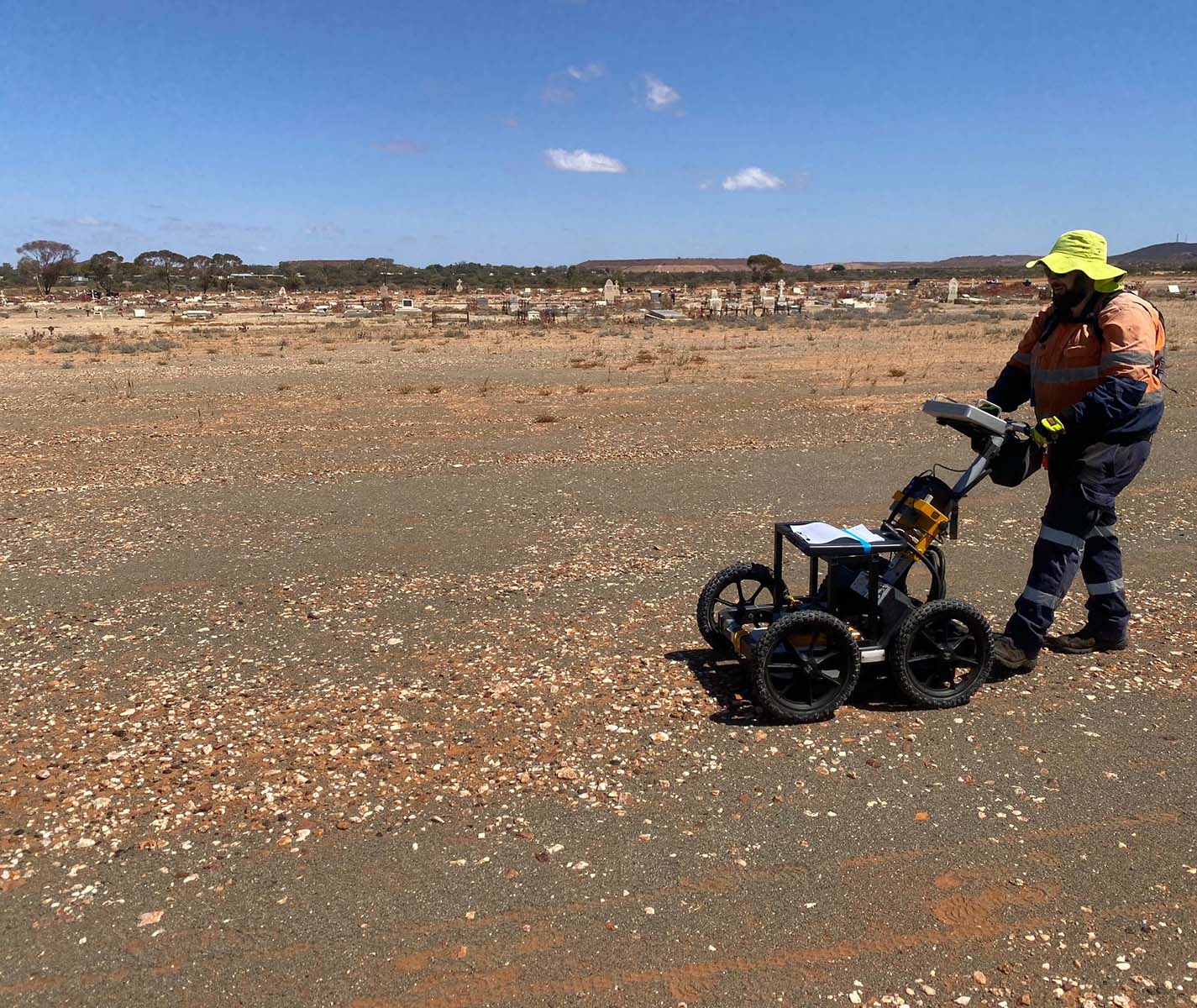
Archaeological studies
Non-destructive geophysical surveys provide valuable insight into what lies beneath the surface, helping archaeologists and heritage professionals identify buried features and areas of subsurface disturbance. Methods including GPR, EM and magnetics can help locate potential archaeological targets before excavation.
Non-destructive geophysical scanning of the sub-surface give archaeologists and heritage officers in invaluable tool for imaging the unknown and providing targets for more invasive archaeology excavation. Geophysical methods such as Ground Penetrating Radar (GPR), Electromagnetics (EM) and magnetics are the more common methods applied to archaeological studies
Ground Penetrating Radar (GPR) is a quick and effective tool for providing assessments on subsurface regions of disturbance or buried structures. GPR is a technique that images the radar reflections that occur between materials/regions when a strong electrical contrast exists between material interfaces. In the case of disturbance zones (e.g. burial locations) or buried structures, these regions will generally produce a strong electrical contrast in comparison to undisturbed surrounding material either-side of the disturbance zone or buried structure. Creating a grid of GPR profiles can help build a 3D amplitude response image of the subsurface to observe for interconnectivity of features, in both horizontal (depth-slice) and vertical (radargram) orientations. Features interpreted from these GPR datasets can provide archaeologists with targets for further archaeology excavation and confirmation of response (when site excavation is an option).
Electromagnetic (EM) methods are quick and effective at highlighting regions of increased soil moisture content e.g. a pit. The geological material surrounding a pit location may generally be more porous and contain a higher water content than the material either side of the pit. Where a strong electrical contrast exists between the higher electrically conductive pit material and lower electrically conductive host material, the general extent of the pit may be mapped.
Magnetic methods are quick and effective at highlighting regions of buried structure or pit activity; human-driven changes to the Earth’s natural magnetic field. Historically filled pit or buried infrastructure may have contained higher contents of permanent magnetisation due to the application of heat e.g. burned wood, fired clay bricks etc., which would contrast with the magnetised content of the local soils. These outlined contrasts can provide archaeologists with targets for further archaeology excavation and confirmation of response (when site excavation is an option).
Find the right solution for your next geoscience project
Talk to our experienced consultants about your project requirements. We help you discover the right approach for understanding subsurface conditions.